
Story By Ben Alford
This week we continue our adventures on Lookout Mountain as we visit Little River Canyon National Preserve, a natural area that joins DeSoto State Park on the Park’s Southern Boundary. As it is for DeSoto State Park, the Little River is the distinctive and defining feature of the National Preserve. Over millions of years the Little River has helped create this landscape of ridges, outcroppings and gorges known as a ‘dissected’ plateau. In some places the canyon, one of the deepest East of the Mississippi River, is as deep as 600 feet.
The Preserve contains 15,000 acres of mountain top and canyon land on which almost any imaginable outdoor adventure can be pursued: swimming, hiking, rock climbing, fishing, hunting, trapping and some of the best white-water paddling in the south. Only experienced kayakers and canoeists should paddle the river below Little River Falls which flows through rapids with names such as “Suicide” and “Avalanche.”
Stop by the Canyon center, 4322 Little River Canyon Pkwy, Fort Payne, AL 35967, for maps and information about trails, activities and programs. The Center is staffed by the US Park Service and the Jacksonville State University Field School. Both organizations provide programs and activities throughout the Preserve. You can also check their websites and follow both on social media to find out more about what is happening every month of the year.

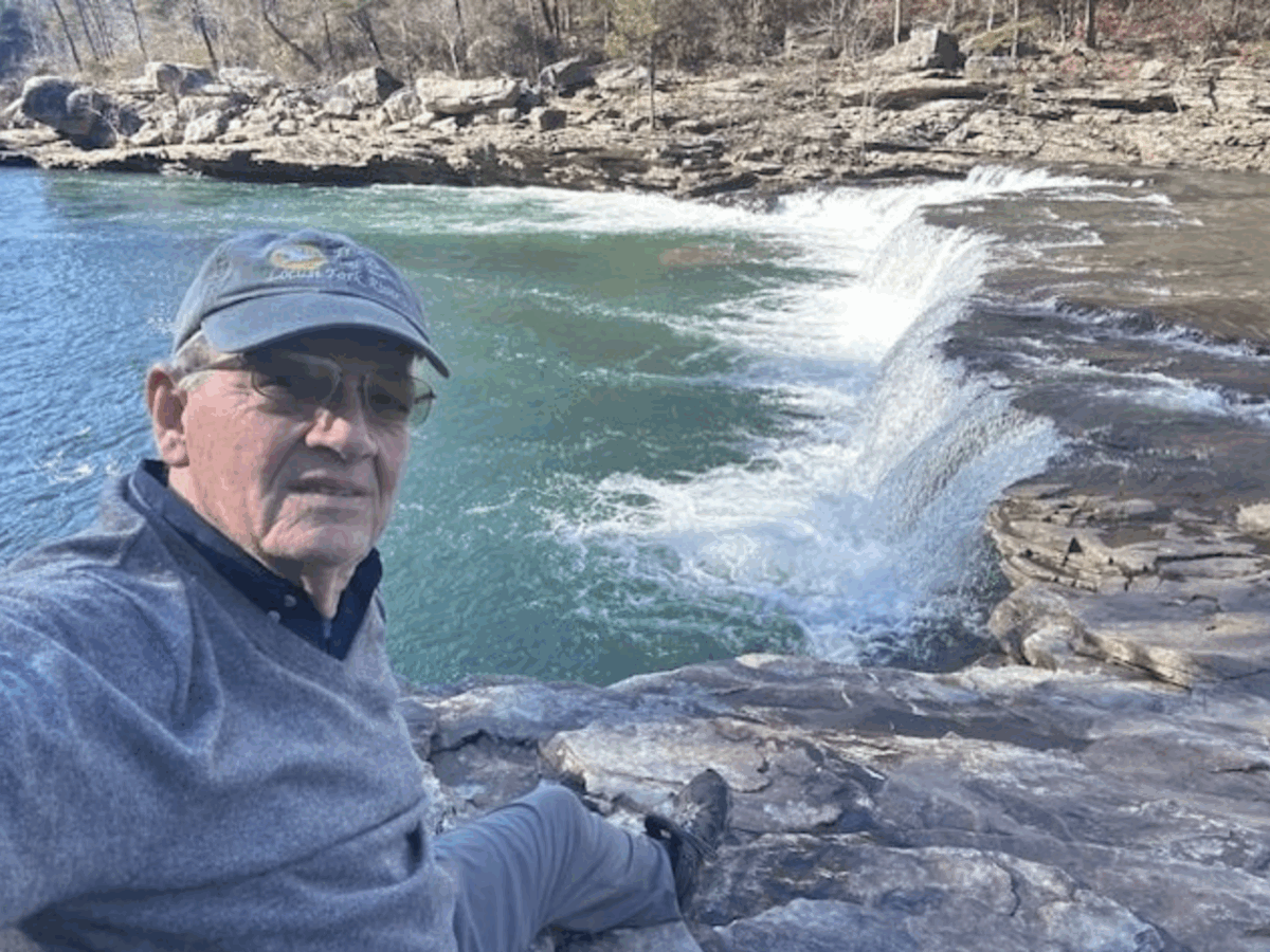
After leaving the Canyon Center, there are two great ways to introduce yourself to the Canyon. The first is to drive to the Little River Falls Parking area and walk down the steps or the ramp to the Falls and River Overlook. After soaking in the splendor, beauty and magnitude of the Canyon and the falls, and if you are up to a 1.5-mile round trip walk and a 137-step set of stairs, head downstream to Little Falls (Martha’s Falls, Hippy Falls). This is a place where you can spend a few minutes or hours absorbing the canyon vibes, meditating on life and creation or simply experiencing something that cannot be put into words.
The second way of introduction is a drive down the Little River Canyon Parkway, (Highway 176) that follows the eleven-mile gorge, stopping at the half dozen or so views into the Canyon. From this drive you will find short steep trails to note for further exploration into the canyon.
Hiking is my preferred activity in the Preserve, so I want to share a few of my favorite trails in addition to Little Falls mentioned above and encourage you to try them out. Many are short but steep and caution is necessary as you climb down and up over rocks and slippery soil. I also recommend hiking these trails with at least one other person. Most of these trails go down to the little river and offer places to wade, swim or sit on the shore and contemplate life and the beauty of creation.
Lower Two-Mile Trail: This short dirt and rock trail descends quickly from the rim to the river and is most used by whitewater kayakers in the winter and spring. Its name is misleading, as the trail is only 0.10 miles, the shortest in length and most direct trail down to Little River. Trailhead Location: Little River Canyon Rim Parkway (Alabama Highway 176) between Mushroom Rock and Hawks Glide Overlook. Trail Difficulty: Arduous/steep. Trail Length: .10 mile/.16 km. Trail Type: Out-and-back.
Eberhart Trail: Venture into the canyon, down to the river and a popular swimming hole. Hikers can look for ruins of Canyonland Park & Zoo, which offered a chairlift down into the canyon along this trail and benches in the woods near the river. When the river is low, hikers can connect with the Powell Trail by hiking down-river. Trailhead Location: Eberhart Point overlook on the Little River Canyon Rim Parkway (AL Highway 176). Trail Difficulty: Arduous/steep. Trail Length: .75 mile / 1.2 km. Trail Type: Out-and-back.
Powell Trail: Explore into Little River Canyon on this trail which leads you along a small stream down to the Little River. Abundant wildflowers reward hikers on this trail in the spring. When the river is low, hikers can connect with the Eberhart Trail by hiking up-river. Trailhead Location: Cherokee County Road 275 about 4 miles south of Eberhart Point Trail Difficulty: Moderate. Trail Length: .75 mile / 1.2 km. Trail Type: Out-and-back.
YCC Loop Trail: Take a hike in the rolling wooded hills of the Wildlife Management Area, Little River Canyon’s backcountry. Most of this trail follows Road 5 and Road 10, with an old out-of-use road linking the two. This portion can be found from Road 10 by going past the gate, continuing the road until reaching a large open field, the trail continues from the far-right side of that field. From Road 5, the road can be found after 2 miles on the left side - watch for pink and blue flagging. Trailhead Location: Road 5 southern terminus (park at large gravel horse trailer parking lot prior to Road 5). Trail Difficulty: Moderate. Trail Length: 3.75 miles / 6 km. Trail Type: Loop.
Reminder: Hunting is allowed in the Wildlife Management Area during designated time periods - use caution.
Fall and winter are perfect times to experience the magic of Little River Canyon National Preserve. So, put on your boots, grab your hiking poles, pack a snack and some water and head for the Canyon.