
Marla Jones, Managing Editor
NORTHEAST, Ala,-- According to several local meteorologist reports, North Alabama is under a Marginal Risk due to Hurricane Ida, which means widespread severe weather is not expected but a few isolated pockets of severe weather is possible.
The remains of Ida will extend east of the center of the storm as it lifts north. The Tennessee Valley will feel impacts from the storm Monday night and Tuesday.

The atmosphere is set up in such a way that tornados could happen if a heavy downpour within Hurricane Ida’s rain bands interacts with the wind shear and instability.
Rain embedded with thunderstorms begins across Northeast Alabama around 2 pm- 6 pm on Monday. Some storms could be severe with wind gusts and possible tornadoes in the evening and night.
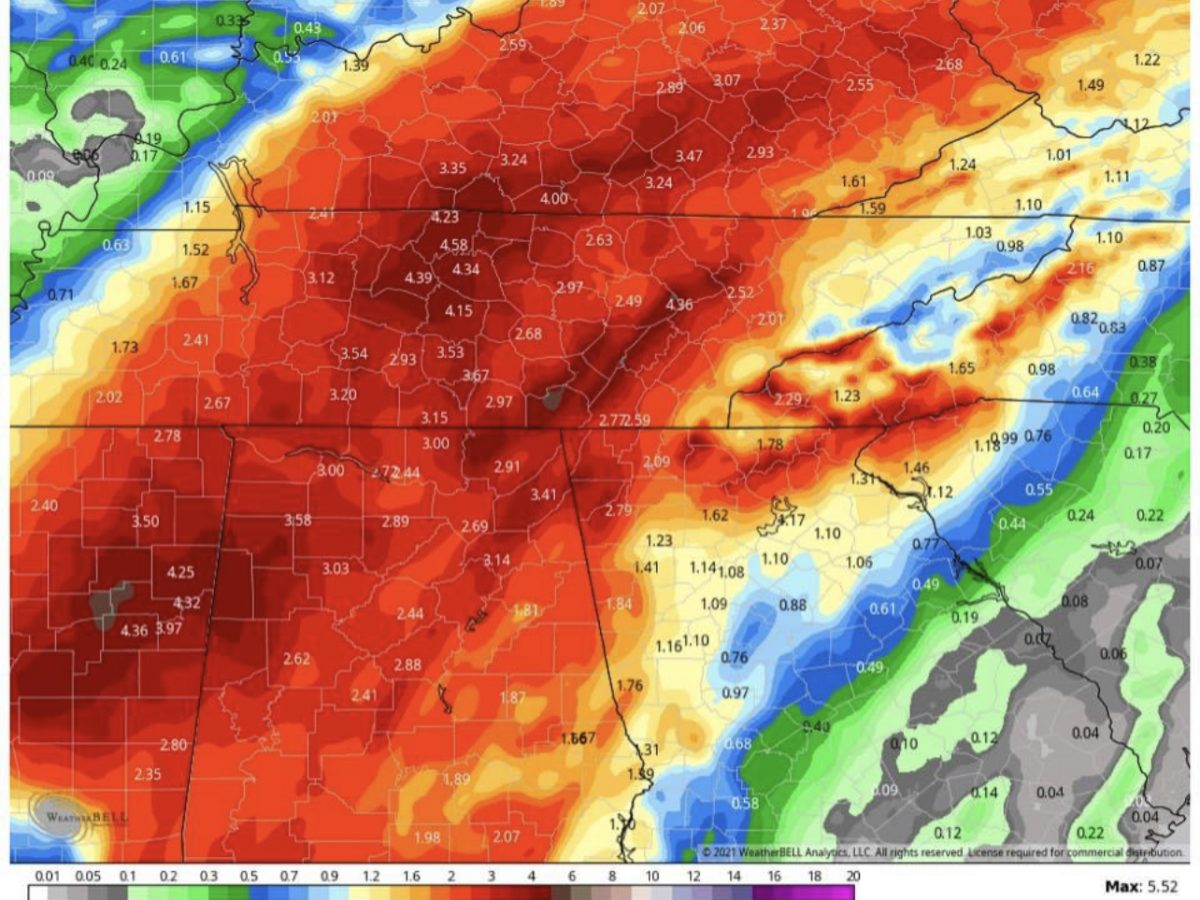
Flooding is also possible as 2-3” of rain is predicted through Tuesday evening. Some areas could get as much as 5” of rain.
Be sure to have an NOAA weather radio with fresh batteries and have your phone charged to receive weather alerts.